In 2011, if you’d asked me if I wanted to backpack, I would’ve looked at you like you were crazy. What a difference 3 years of running trails and ultras can do to one’s endurance and the love for outdoors! Next to ultra-running, backpacking is the most elegant way (especially for families) to move through the mountains light, leave no trace and experience the fullness of outdoors. Not to mention completely getting off the grid and the joy of missing out. There’s a certain simplicity in living off of what you can carry on your back, that beats car camping every which way.
My family (4 of us) spent a couple of days at the Vermilion Valley Resort, acclimatizing and hanging out with our friends who were doing a much longer loop from Mammoth down to Edison Lake and then back. Three years ago when I visited this place, the lake was full and overflowing. So it was a little depressing to see that the waterline had receded a full 2 miles from the banks. I managed to sneak in a 9-mile run up on the Goodale Pass Trail, panting like crazy and getting used to running in high elevation. We played a couple of rounds of frisbee-golf on the lakebed too.
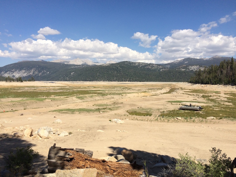
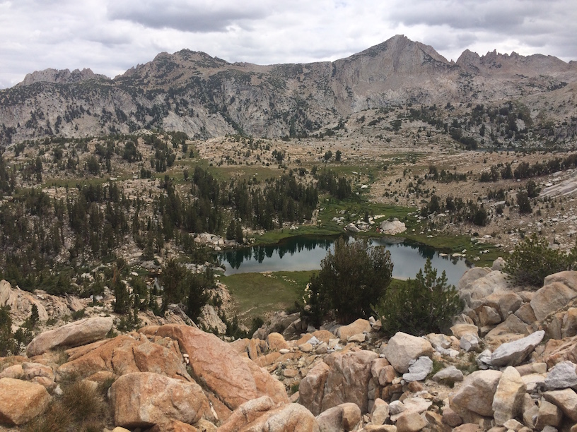
Edison Lake
The plan was to backpack up and over Goodale Pass, get to the backside towards Grassy Lake and then return back to Edison Lake via Silver Pass and take the John Muir Trail back. Here’s the full (merged) Strava activity from my Ambit3. We covered around ~31 miles in 4 days with total elevation gain of 6,000ft.
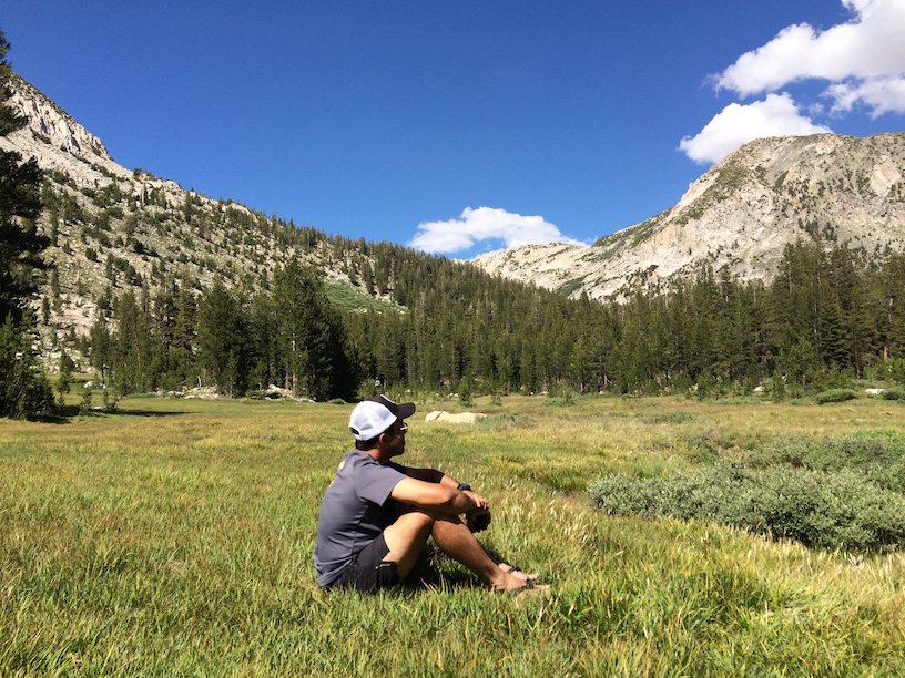
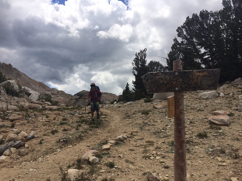
Day 1 – Upper Graveyard Meadow
We left on Saturday morning @ 8:45am from the resort. I had about 29 lbs + 3 liters of water on my spanking new Osprey Exos 58 (including a bear canister). It’s a splurge, but love at first fit. I could feel the weight completely loaded on my hips and didn’t have a single night of sore shoulders or back. We kept a good pace on the steady climb up the fully shaded Goodale Pass Trail. I was wearing Merrell Trail Glove 2 and on the first creek crossing, switched to Luna Sandals. The meals were fairly simple. Breakfast and Dinner were freeze-dried food and I would highly recommend the Jetboil Personal Cooking System. It almost made us feel guilty that we didn’t have to do much for a meal other than boiling water. We stopped at the Upper Graveyard Meadow and setup camp by the creek. Distance: 9.3 miles.
Upper Graveyard Meadow
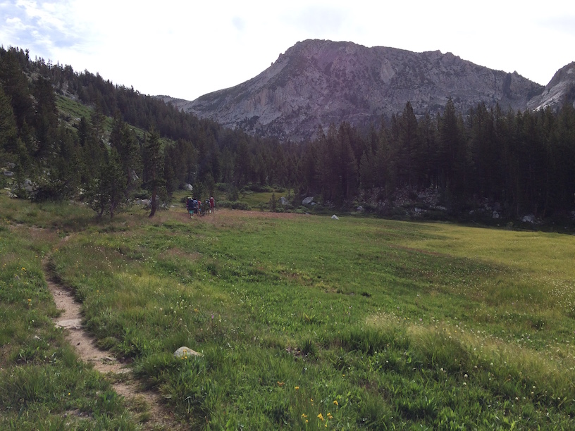
Day 2 – Over Goodale Pass to Grassy Lake
We used two means of getting clean water. The Sawyer Gravity Filtration System which gets about a liter every 10 minutes and a Steripen Handheld Water Purifier that we primarily used when pressed on time. I carried a 3-liter Hydrapack, my wife and 14yo 2-liter packs each and my 12yo, a 1.5 liter one. Plus a Nalgene. Depending on the terrain we were covering and the creek crossings, we varied the amount of water (lesson learned from running ultras) and the strategy worked pretty well.
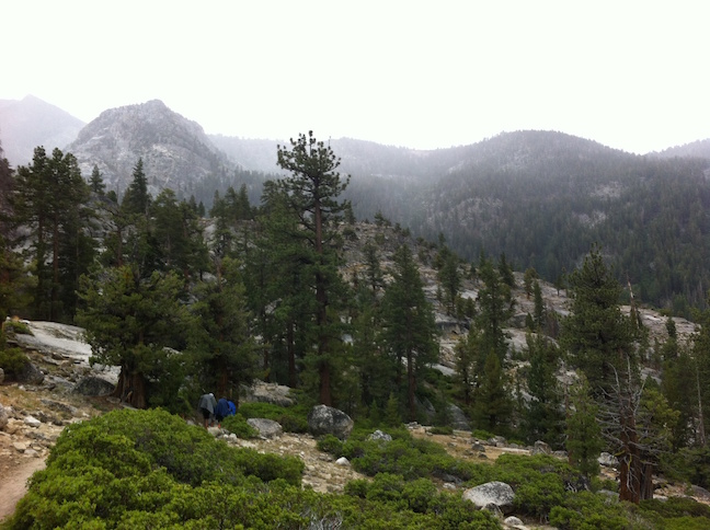
Up to Goodale Pass
Switchbacks up to Goodale Pass
Papoose Lake
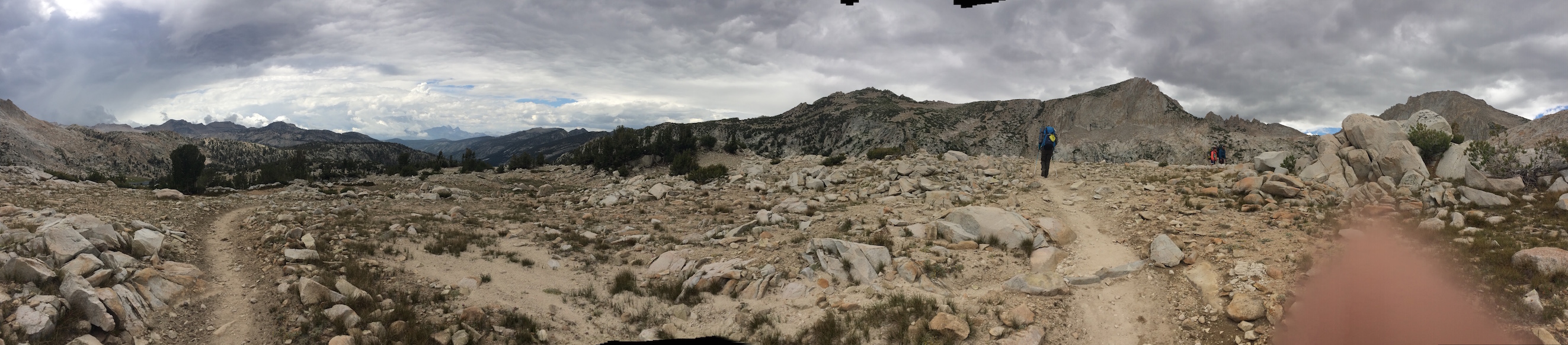
The climb up to Goodale Pass was pretty steep with a series of switchbacks on gravel and loose rocks. Wow’s on every turn. However, the dark clouds moved in fast, temperature dropped and we had to push to get over to the other side. Marmot sightings at 11,000 feet! A relaxed stop at Lake of the Lone Indian and then we descended rapidly towards Grassy Lake. It started drizzling and the mosquitoes were finding their ways through the ponchos. By the time we setup camp, the rain had stopped, but we were back at the same elevation where we started this morning. Distance: 6.7 miles
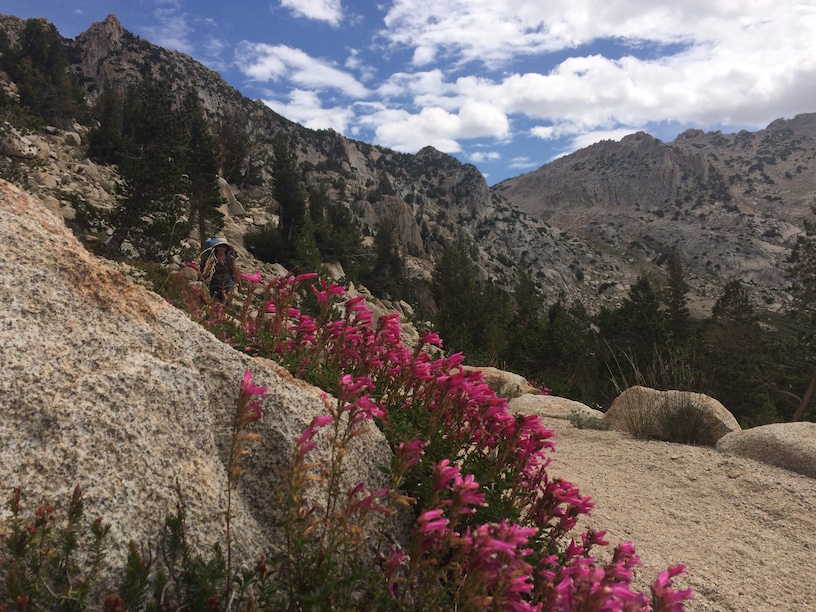
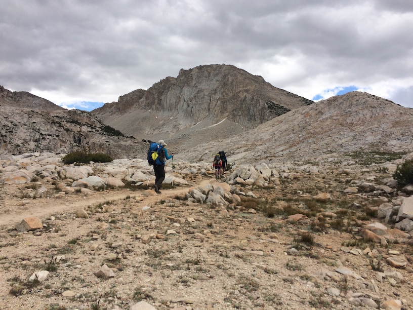
Day 3 – Over Silver Pass on John Muir Trail
We said goodbye to our friends and backtracked our way up to the JMT junction. It was a surprisingly easy ascent back up to 10,000 ft and we stopped at Papoose Lake for lunch. It was warm and the next water was up over Silver Pass and 3 miles down to the creek. We filled up water to the brim and just as we started Sierra did her afternoon thing again. Dark clouds, sharp drop in temperatures and the wind picked up.
John Muir Trail, close to Silver Pass
Top of Silver Pass
Descending from Silver Pass
Top of the Silver Pass had the most amazing 360 views. We hooted and hollered at the top, watched a few Marmots but slowed down the pace now that the hardest part was over. Everyone was in a cheerful mood as the sun followed us while the ridges around us were dark and we could hear the thunder rumbling in the distance. We found the most awesome camping site by the creek crossing about 2.5 miles from the summit. I was drooling over the scree and thinking what an amazing downhill run this could be. Once a runner, everything looks like an opportunity to run, I guess. 🙂
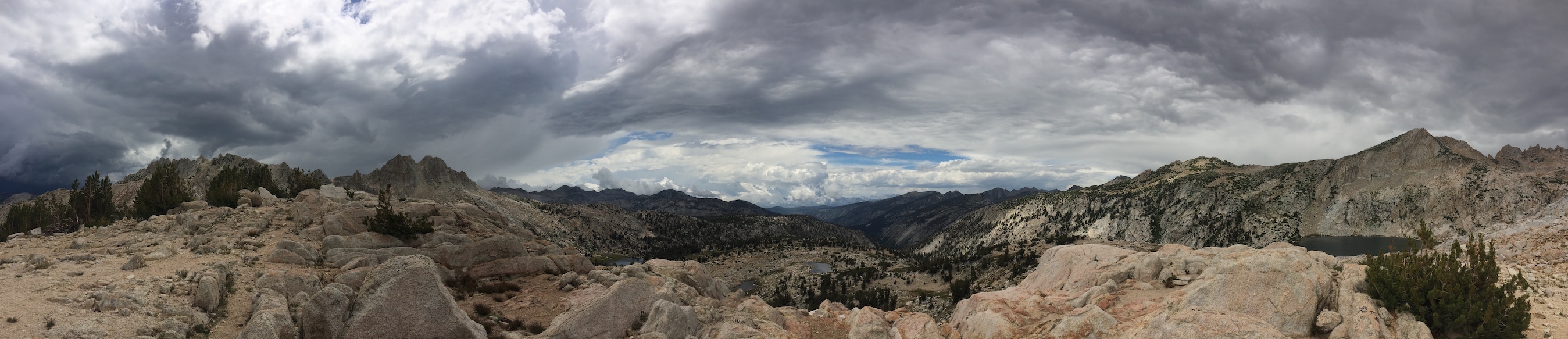
Sunny Skies & Dark Clouds
By now we were getting into a rhythm. Set up the tent, get the water filter going, open the bear canisters and get dinner out. This time though, we were below 10,000 ft and could get a fire going which totally completed the afternoon. Distance: 8.2 miles
Day 4 – The Rainy Hike to Edison Lake
We had a spectacularly uneventful morning where we woke up late, made a relaxed breakfast, played card games, explored the creek and just hung out. My 12yo and I had a itty-bitty taste of “sky running” by scrambling over steep granite and then running down them as fast as we could. SO MUCH FUN!
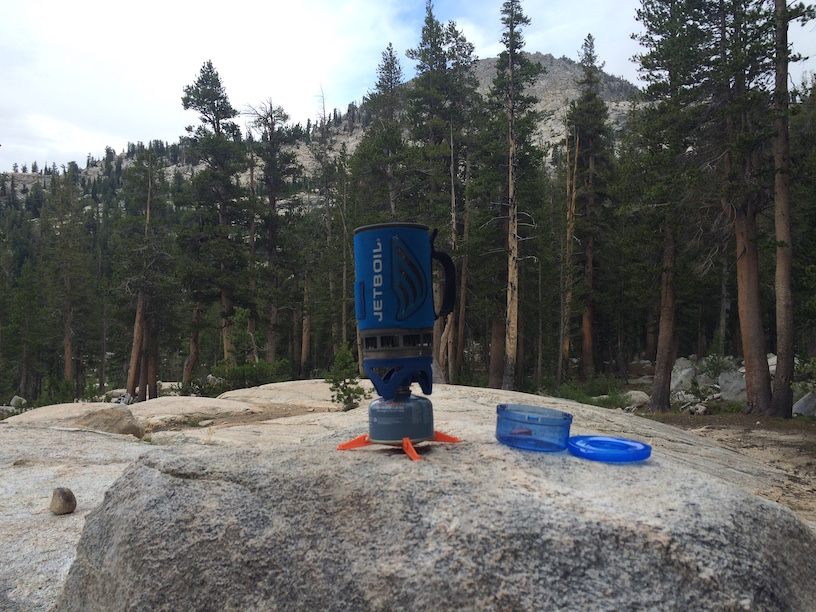
Jetboil FTW!
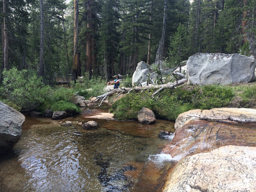
Creek side camping
By noon, the clouds moved in rapidly and we had to tear down camp quickly (see the pattern here?). Lunch was on the go and the drizzling started in earnest. Ponchos on we trudged along as the skies around looked pretty mean. Navigated the long series of switchbacks leading down to the Mott Lake junction. We were finally out of the exposed areas and below the tree line. Kept counting the arrival of thunder right after each lightning to gauge how far it was.
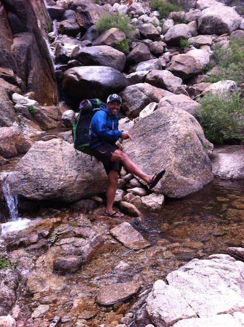
Creek crossing in Luna Sandals
Descending into Vermilion Valley
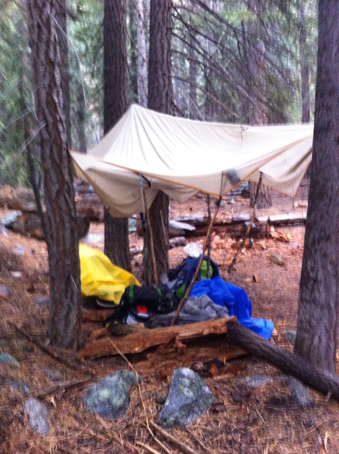
Emergency Shelter With the Rain Fly
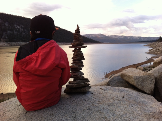
My 12yo with his 35-stone cairn masterpiece
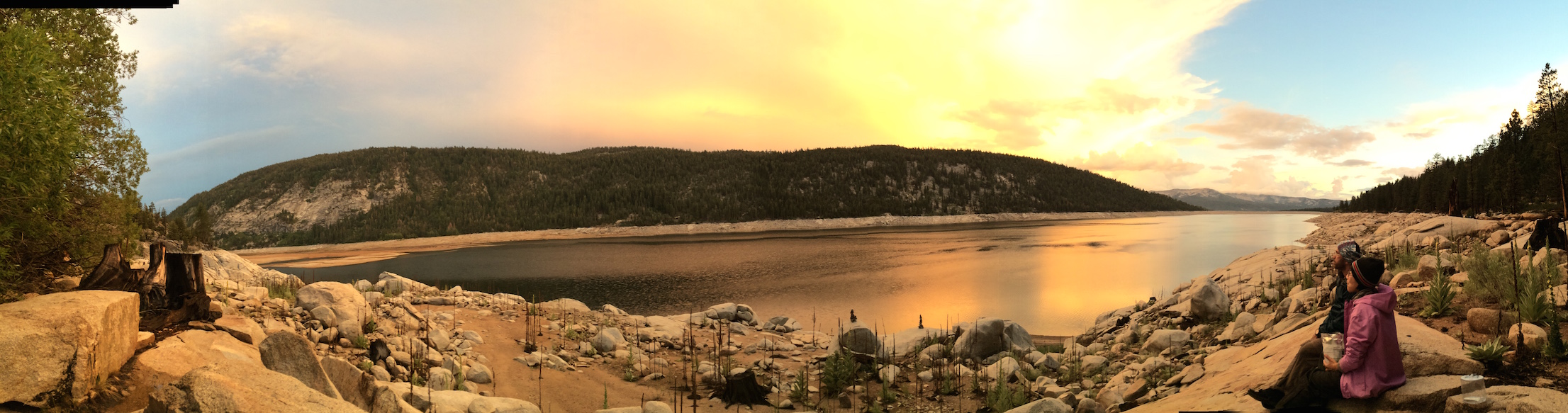
Last sunset on the other side of Lake Edison
Originally we were planning on camping at Quail Meadows for the night and then taking the ferry back to the resort, but after hiking in the rain for a few hours and not eating a big lunch, everyone was tired. We setup an emergency camp with the rain fly, cooked up a meal and continued a little past the ferry until we saw the most amazing boat camp site. Of course, water level was 30 feet below the site, but still. We had the place to ourselves while being treated to an amazing sunset. Distance: 7.1 miles
The morning of day 5, we backtracked a little and caught the ferry back to the resort to make it in time for a fantastic breakfast and warm showers. Overall, it was an epic adventure in the wilderness and it inspired my 12yo (who shares his birthday with John Muir) so much so that he wants to through hike the JMT when he’s 15. Now that’s achievement unlocked!
[sc:follow_me]