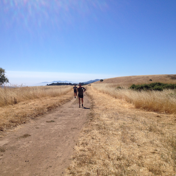
This past weekend, I had the pleasure of running with a few friends at Windy Hill Open Preserve in Portola Valley. I was originally going to go back to Los Trancos and see if I could finish the loop again without taking the wrong turn, but then found out Robert Rhodes with BayTrailRunners had this fantastic 17-mile loop (~3,000ft elevation gain!) on his calendar. I ran the Coastal Marin 50K with him earlier this year and it turned out to be an epic run. I usually try and take as many pictures to document the route in the Bay Area Trail Running series of blogs, but this time I wasn’t prepared (and my phone died along the way too). Luckily, Robert has put together an awesome video that captures the highlights of this loop that starts from Windy Hill, running past Coal Creek Preserve and through Russian Ridge returning back again to Windy Hill.
Windy Hill – Portola Valley
Windy Hill in Portola Valley is a 1,335-acre preserve featuring fantastic ridges and forests of redwood, fir and oak. Even though the preserve only has 12 miles of trail, this 17-mile loops connects with the adjacent Russian Ridge. We parked at the intersection of Alpine Road and Willowbrook Dr. (see Google Maps) and starting running around 9am. There’s limited parking here (maybe about 15 cars or so?) so you’ll have to get there early. Right across from the parking lot, there’s a trail that begins the climb and pretty soon you’ll find yourself on the meandering Toyon Trail running through shaded oaks. The trail hugs the Alpine Road for a couple of miles so you’ll get your share of dirt. Eventually make a right on Lake Trail to get back on Alpine Road. A short climb on asphalt and you’ll find the entrance to Alpine Road Trail on you right, taking you through Coal Creek Open Preserve. You’ll pass Cloud Rest and Meadow trails and it just keeps climbing up and up. After the last push, you’ll end up on Page Mill Road. Make a right and continue up towards Skyline Boulevard.
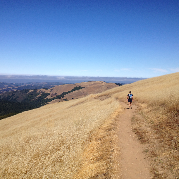
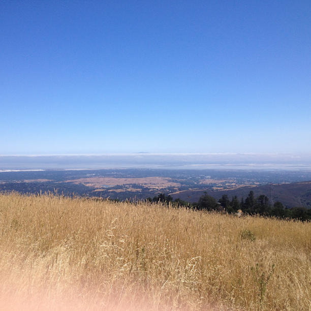
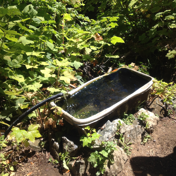
Cross Skyline Boulevard and you’ll be officially entering Russian Ridge, which is fairly exposed. I wasn’t carrying any water, but if you go under the bridge to the left towards Alpine Pond and David Daniel’s Nature Center, there’s a water fountain (2:20 into the video) there. Hopping back on Ridge Trail, there’s more climbing for the next couple of miles with spectacular views of the Bay Area. We could even see Mt. Diablo peeking out from the clouds to the east. The Ridge Trail eventually dead-ends into Rapley Ranch Rd. Make a right and head up north on Skyline Boulevard for about 500 feet when you’ll see the entrance to the Lost Trail to your right. After the exposed section on Russian Ridge, it was nice to be back under oaks and redwoods again. Shortly after there’s another water-hole (literally) to the side of the trail with a hose coming out of the ground bringing spring water up. Apparently people drink out of this, even though there’s no recommendation from the rangers one way or the other. Continue on Lost Trail to the last climb up Anniversary Trail and then heading down on a steep 1.6 mile down Spring Ridge Trail back to the parking lot.
 That was a fair bit of climbing and I did wish we had started a little earlier in the day. The Russian Ridge part was pretty exposed, but I love this run given there are convenient water stations along the way. Checkout BayTrailRunner’s Calendar and don’t miss out on the next opportunity to run this!
Have you run in Windy Hill or Russian Ridge before? What’s your favorite route?
[sc:follow_me ]